Identity area
Reference code
Bpad.Orba.T5-Bpad.Orba.T5.I.-Bpad.Orba.T5.II.-Bpad.Orba.T5.II.1.-Bpad.Orba.T5.II.2.-Bpad.Orba.T5.II.3.-Bpad.Orba.T5.II.4.-Bpad.Orba.T5.II.5.-Bpad.Orba.T5.II.6.-Bpad.Orba.T5.II.7.-Bpad.Orba.T5.III.-Bpad.Orba.T5.III.1.-Bpad.Orba.T5.III.2.-Bpad.Orba.T5.III.3.-Bpad.Orba.T5.III.4.-Bpad.Orba.T5.III.5.-Bpad.Orba.T5.IV.-Bpad.Orba.T5.IV.1.-Bpad.Orba.T5.IV.2.-Bpad.Orba.T5.IV.3.-Bpad.Orba.T5.V.-Bpad.Orba.T5.V.1.-Bpad.Orba.T5.V.2.-Bpad.Orba.T5.V.3.-Bpad.Orba.T5.V.4.-Bpad.Orba.T5.V.5.-Bpad.Orba.T5.VI.-Bpad.Orba.T5.VI.1.-Bpad.Orba.T5.VI.2.-Bpad.Orba.T5.VI.3.-Bpad.Orba.T5.VI.4.862
Title
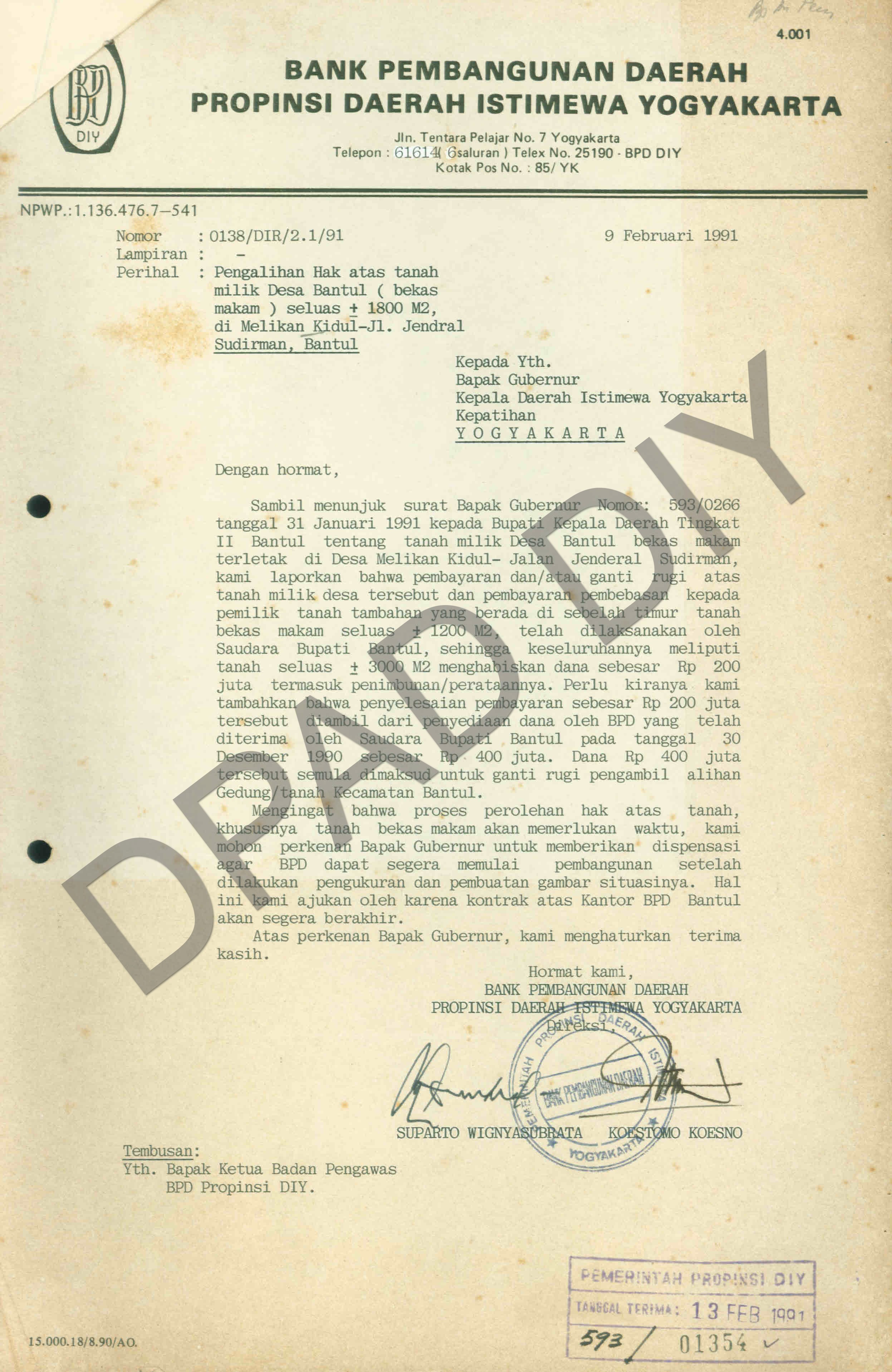
Surat dari Bupati Bantul, KRT.Suryopadmo Hadiningrat kepada Gubernur Daerah Istimewa Yogyakarta perihal penyediaan tanah untuk pembangunan Kantor Cabang Bank Pembangunan Daerah (BPD) Bantul di lokasi tanah bekas makam/kuburan umum Malikan Kidul seluas ± 1800 m² dan tanah milik penduduk seluas ±1200 m², yang kesemuanya terletak di Jl. Jendral Sudirman, Bantul (tepatnya di sebelah selatan perempatan Klodran). Surat dari Direksi Bank Pembanguan Daerah Propinsi DIY, Suparto Wignyasubrata dan Koestomo Kesno, Kepada Gubernur DIY perihal pengalihan hak atas tanah milik Desa Bantul (bekas makam) seluas ±1800 m² di Melikan Kidul Jl. Jendral Sudirman, Bantul.
Date(s)
- 1991 - ? (Creation)
Level of description
Item
Extent and medium
1 LEMBAR dan 1 LEMBAR
Context area
Name of creator
Repository
Archival history
Immediate source of acquisition or transfer
Content and structure area
Scope and content
Appraisal, destruction and scheduling
Accruals
System of arrangement
Conditions of access and use area
Conditions governing access
Conditions governing reproduction
Language of material
Script of material
Language and script notes
Physical characteristics and technical requirements
Finding aids
Allied materials area
Existence and location of originals
Existence and location of copies
Related units of description
Notes area
Alternative identifier(s)
Access points
Subject access points
Place access points
Name access points
Genre access points
Description control area
Description identifier
Institution identifier
Rules and/or conventions used
Status
Level of detail
Dates of creation revision deletion
Language(s)
Script(s)
Sources
Digital object metadata
Filename
ASSEK_I.2010.862.jpg
Latitude
Longitude
Media type
Image
Mime-type
image/jpeg
Filesize
567.1 KiB
Uploaded
May 20, 2020 9:01 AM